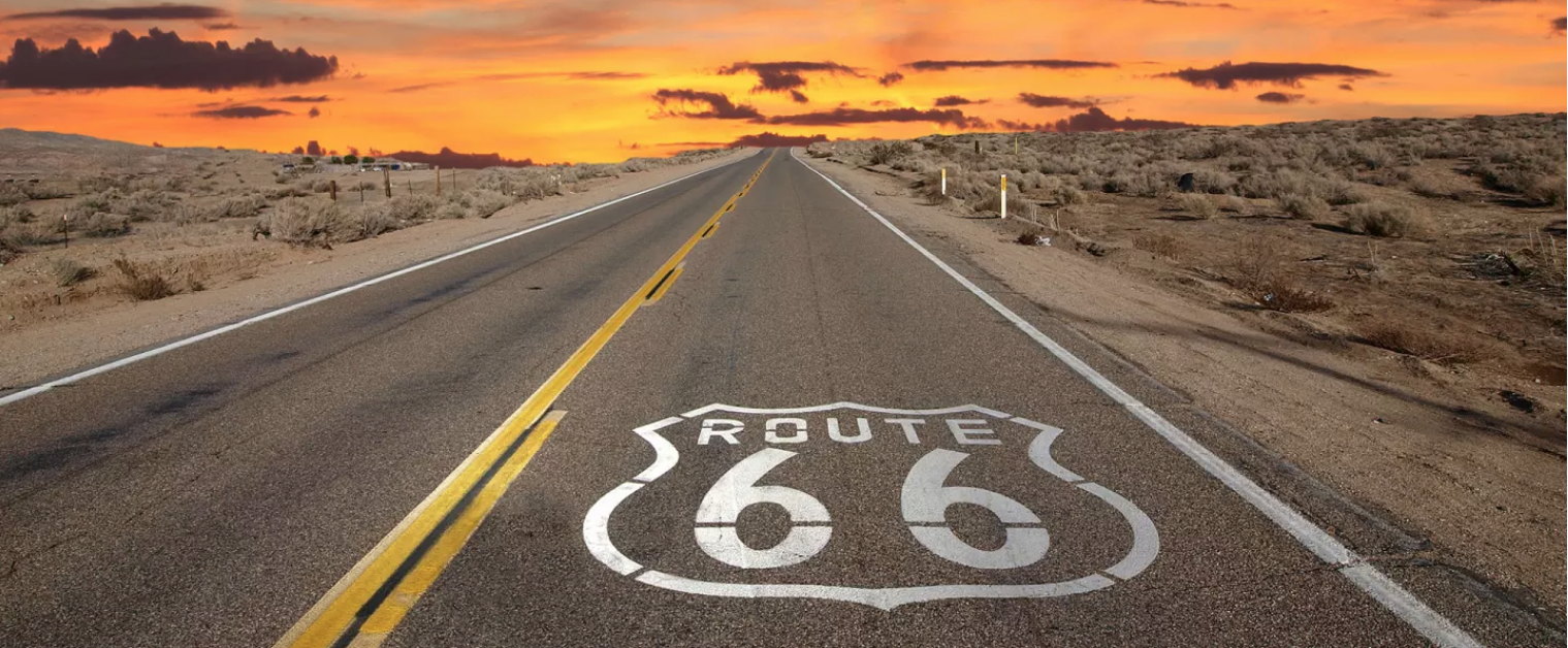
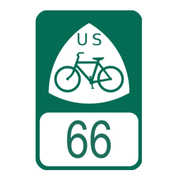
USBR 66 across California
from Needles to Santa Monica
Part of 'AMERICA'S HIGHWAY'
CHICAGO to LOS ANGELES
(Lake Michigan to the Pacific Ocean)

USBR 66 across California from Needles to Santa Monica Part of 'AMERICA'S HIGHWAY' CHICAGO to LOS ANGELES (Lake Michigan to the Pacific Ocean) |
||
| Local Jurisdictions our team has worked with... (Maps if hyperlinked) |
ACA |
Local Support submitted |
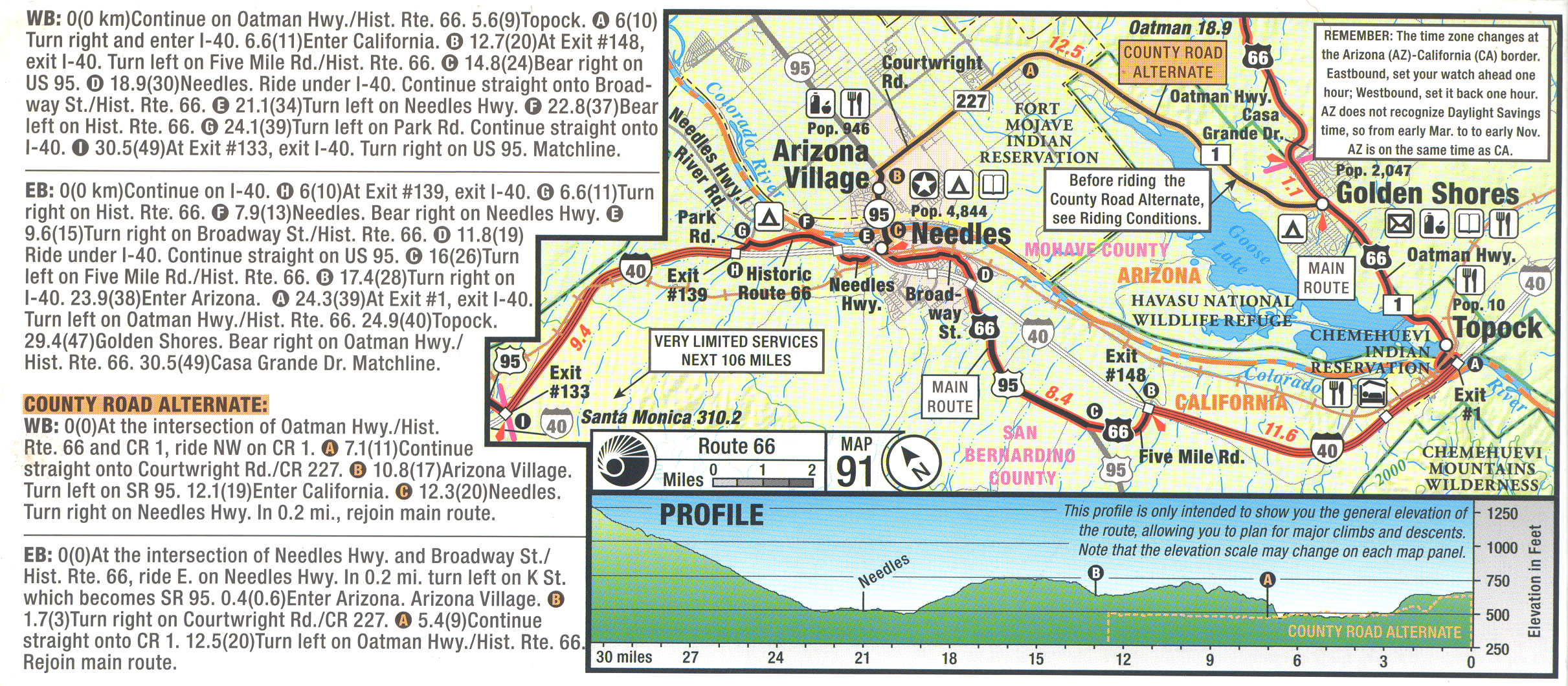
| 1: √ Needles (National Old Trails Rd to West Park Rd) | |
Jan 24, 2017 |
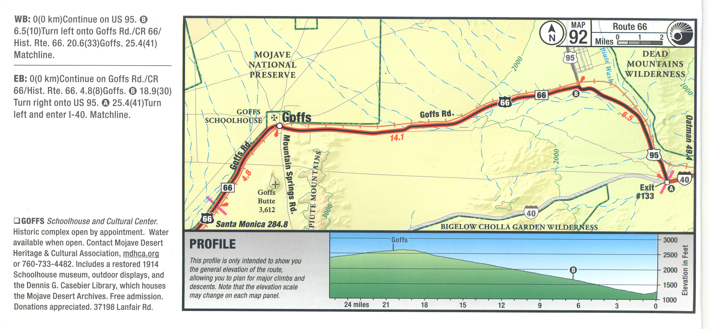
| 2: √Mohave Trail National Monument (Goff's Rd-Nat.Trails Hwy) | |
CalTrans |
| 3: √Fenner, Amboy, Ludlow, Newberry Springs, Lenwood | |
CalTrans |
| 4:√ Barstow | |
March 19, 2018 |
| 5:√ Victorville | |
May 10, 2018 |
| 6:√ Hisperia | Supports USBR 66 |
|
| 7: √ San Bernardino Natonal Forest (No National Forest Roads used) |
NA | |
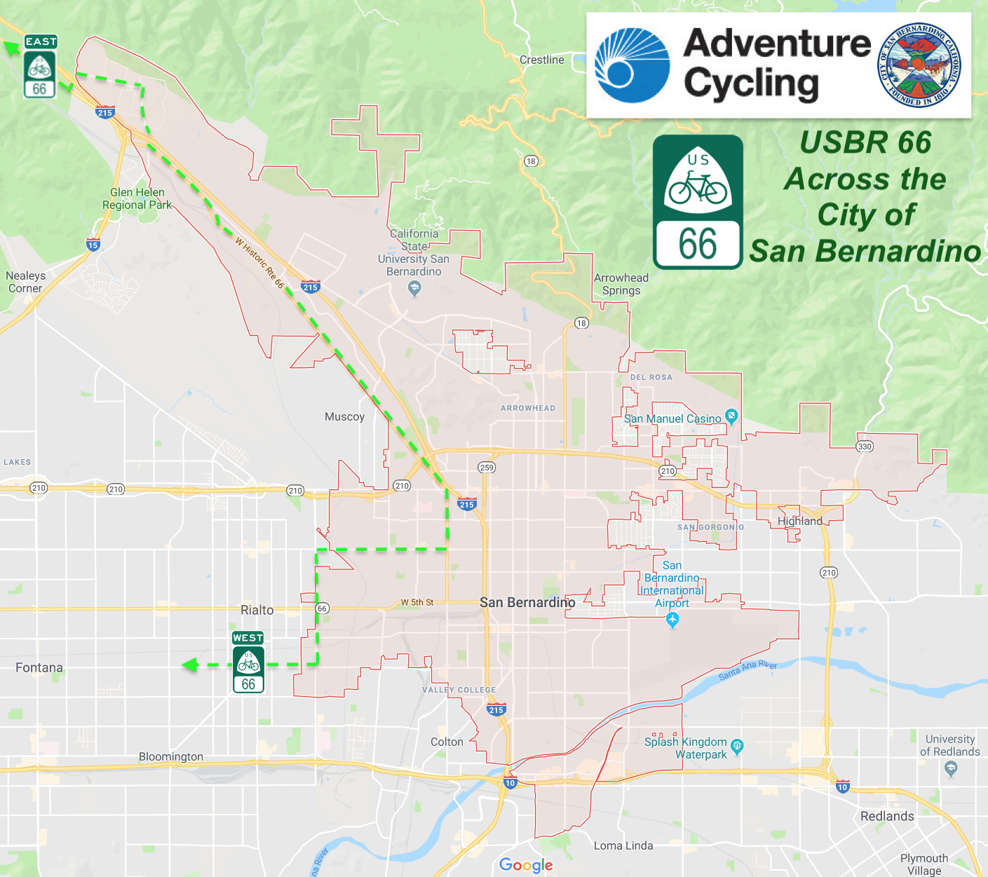
| 8:√ San Bernardino | |
Sep 4, 2018 |
| 9:√ Rialto | Oct 16, 2017 | |
| 10:√ Fontana | |
June 13, 2017 |
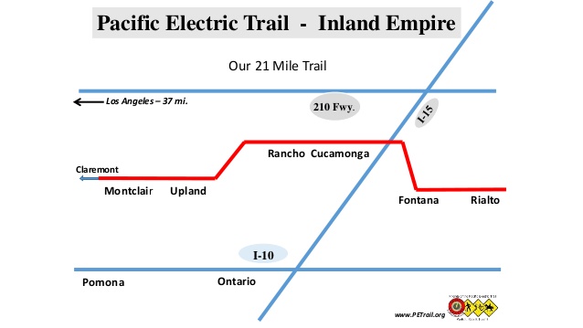
| √San Bernardino County - Pacific Electric Trail bikeway |
June 25, 2018 |
|
|
11: √ Rancho Cucamonga (Pacific Electric off-street) |
SB County | |
| 12: √ Upland (Pacific Electric off-street) | SB County | |
| 13: √ Montclair (Pacific Electric off-streets) | SB County | |
|
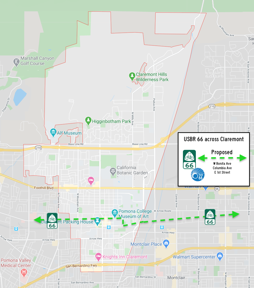
14: √ Claremont [In the News] |
Mar 24, 2020 | |
|
15: √ Pomona [In the News] [.png] |
Feb 26, 2019 |
|
| 16: √ La Verne | Oct 21, 2019 |
|
| 17: √ San Dimas | Jul 28, 2020 |
|
| 18: √ Glendora | |
Oct 13, 2020 |
| 19: √ Azusa | Aug 16, 2018 |
|
| 20: Irwindale (Route now proposed to go from Azusa to Duarte) |
NA | |
| 21: √ Duarte | Mar 12, 2019 |
|
| 22: √ Monrovia | Mar 5, 2019 |
|
| 23: √Arcadia | Feb 7, 2017 | |
| 24: √ East Pasadena (LA County) | Feb 27, 2018 | |
| 25: √ Pasadena | March 8, 2017 | |
| 26: √ South Pasadena | April 19, 2017 | |
| 27: √ Alhambra | April 24, 2017 | |
|
28.1:√ City of Los Angeles (East) (1 of 2 segments plus 5 of USBR 95) |
|
Nov 2, 2020 |
| 29: √ West Hollywood | March 23, 2017 | |
| 30: √ Beverly Hills | May 30, 2019 |
|
| 28.2: √ City of Los Angeles (West) (2 of 2 segments plus 5 of USBR 95) | Nov 2, 2020 | |
| 31: √ Santa Monica | May 5 2017 | |
| Current Draft Map - East to West |
Current Draft Map - West to East |
|
FORBES Aug 24, 2021 "New Bike Routes Added In 5 States, Largest Growth To U.S. Bicycle Route System" by Tanya Mohn
 See more on Adventure Cycling's USBR project adventurecycling.org/routes-and-maps/us-bicycle-route-system/national-corridor-plan/ U. S. Bicycle Route System The Western end of USBR 66 on 100+ year old 1919 Auto Club Map:  For more information, contact Bill Sellin, Volunteer Adventure Cycling Association Member #Z208575 (714) 943-3678 usbr66ca@gmail.com www.facebook.com/usbrs/ Interested cyclists can keep up-to-date on the USBRS by subscribing to Adventure Cycling's quarterly eNews Mashable April 2016 Albuquerque Journal May 2016 Streetsblog Los Angeles June 2016 Springfield News-leader February 2018 News Tribune May 2018 The Conversation June 2018 The Guardian July 2018 Bloomberg July 2018 Bloomberg March 2015 Lonely Planet July 2018 The Manual August 2018 The Edmund Sun June 2019 The Pittsburg Morning Sun November 2019 The Ottawa Herald November 2019 |
 The news was announced on Monday by the Adventure Cycling Association.
![[.png]](USBR_images/Clairmont.png)