| Date | From: | To: | Maps: | Route Details |
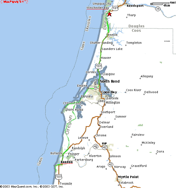
| Thursday July 31 | Winchester Bay | Bandon | 64 miles | Sunset
Inn 800-842-2407 |
|
| ||||
| TURN | ONTO: | FOR: | TOTAL | LANDMARKS: |
| Broadway | .5 mile | 0.5 mile | ||
| Left | 8th Street | .1 miles | .6 miles | |
| Right | Hwy 101 South | through Lakeside | ||
| Right | Florida | past the Coos Bay Bridge | ||
| Left | Manage Ave | through North Bend | ||
| Right | Virginia | |||
| Left | Broadway | |||
| Right | Cape Arago Hwy | through Charleston to end at Cape | ||
| Return | Cape Arago Hwy | back toward Charleston | ||
| Right | 7 Devils Road | |||
| Left | West Beaver Road | |||
| Right | E Humphreys Rd | |||
|
| 7 Devils Road | |||
| Left | Hwy 101 South | |||
|
| Riverside Dr | Bandon | ||
|
| 1st Street | |||
| Left | Edison | |||
|
| Ocean | |||
|
| 7th Street | |||
| Left | Beach Loop Road | 64 miles | to Sunset Inn on Left | |
 PHOTO ALBUM !
(click the dates)
PHOTO ALBUM !
(click the dates)
| Day 1 | Day 2 | Day 3 | Day 4 | Day 5 | Day 6 | Day 7 |
| Sunday July 27 | Monday July 28 | Tuesday July 29 | Wednesday July 30 | Thursday July 31 | Friday August 1st | Saturday August 2nd |