  ROUTE DETAILS:
 "It is by riding a bicycle that you learn the contours of a country best, since you have to sweat up the hills and coast down them. Thus you remember them as they actually are, while in a motor car only a high hill impresses you, and you have no such accurate remembrance of country you have driven through as you gain by riding a bicycle." -Ernest Hemingway ROUTE CUE SHEET ARE FINALIZED & PRINTED! PDF available HERE! We will ride some of the very best of the beautiful Northern California Coast & Wine Country If you can get AAA Maps, the City Series maps for Santa Rosa - Rohnert Park & Napa Valley give detail for much of the tour. California Regional Series maps for SanFrancisco Bay and Mendocino & Sonoma Coast are a larger scale with less detail but cover the entire tour. If you like bicycle maps, check out KREBS North San Francisco Bay & Wine Country at http://www.krebscycleproducts.com/index.html You may also want to order the Sonoma County Bicycle Coalition's map at http://www.bikesonoma.org/content/sonoma-county-bicycle-map Here's the itinerary. The
cue sheets for Saturday's routes will
be distributed at the Saturday morning assembly on May 20th. The
rest will be handed out at the evening orientation meeting each night
for the following day. (or you can download & print your own now) If
you would like to review routes & see the big picture,
here are some of the routes Doug has plotted: We’ll feature routes of various distances and challenges to accommodate riders of all fitness levels. Routes offered: 29.6 33.8 & 57.6 miles 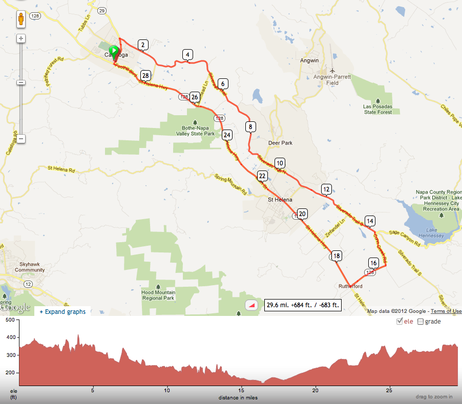  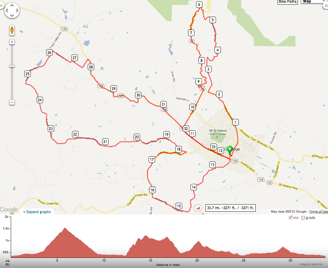  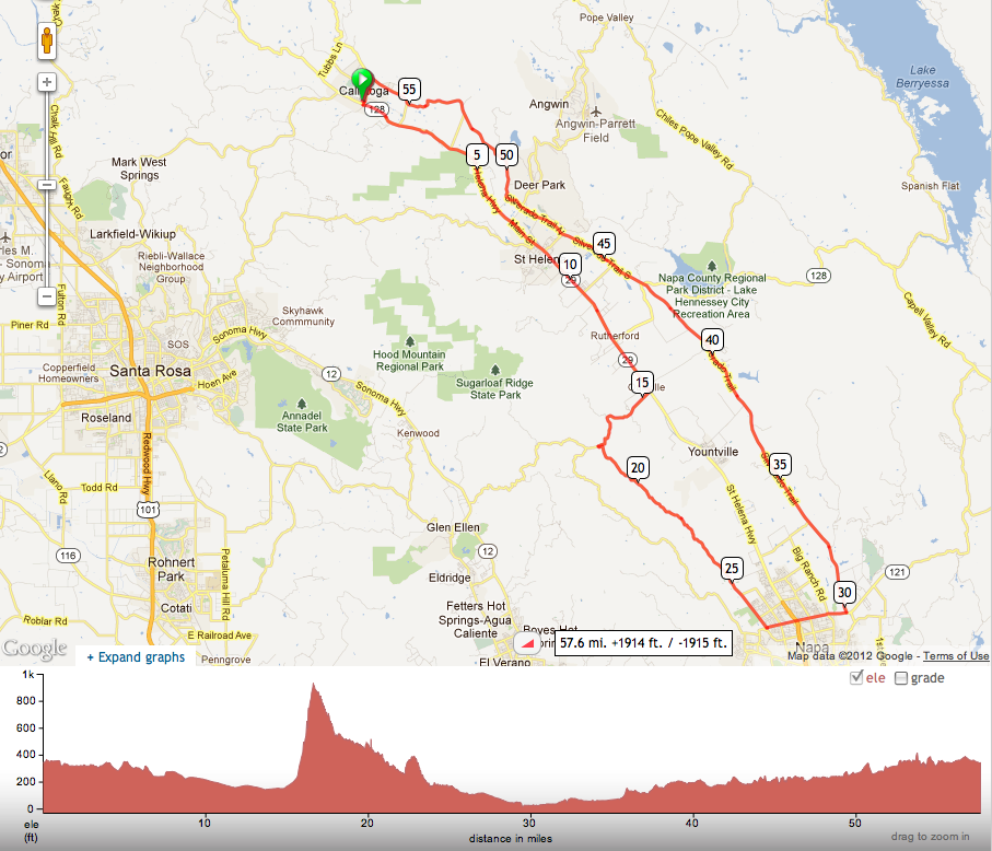  After our rides, we’ll drive to Santa Rosa (only 17 miles) http://g.co/maps/9x4pj Day 2: Monday’s adventure, May 21st, takes us from Santa Rosa to Healdsburg. Multiple route options allow riders to select a distance that fits their interest. There will be several scenic options: 21.8, 36.5, 49 & 77.3 miles. 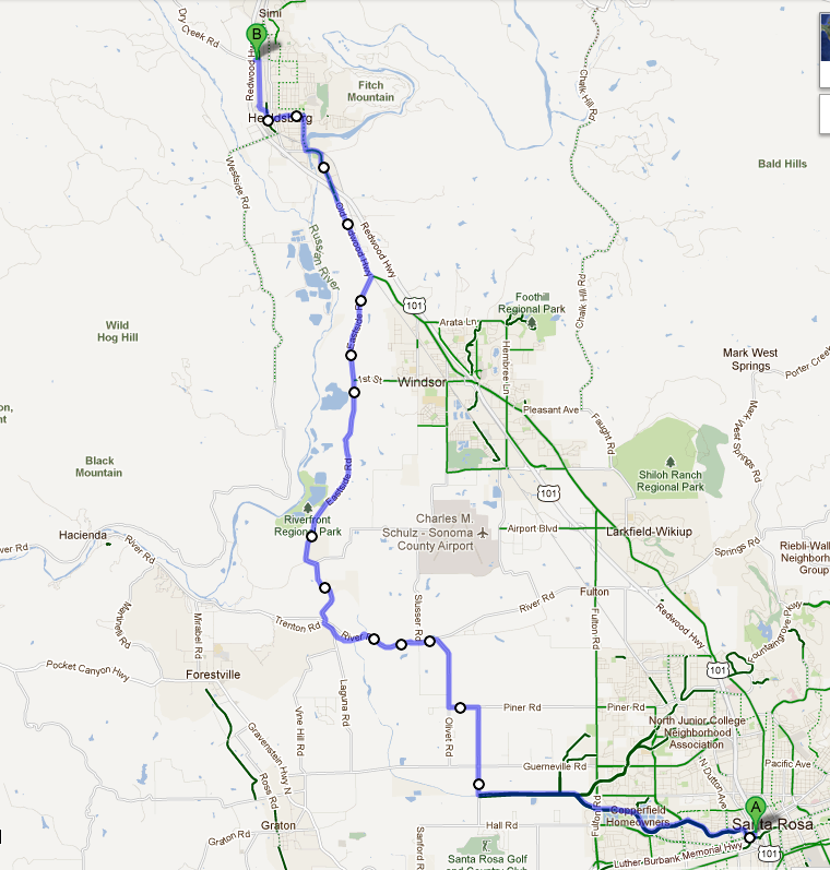 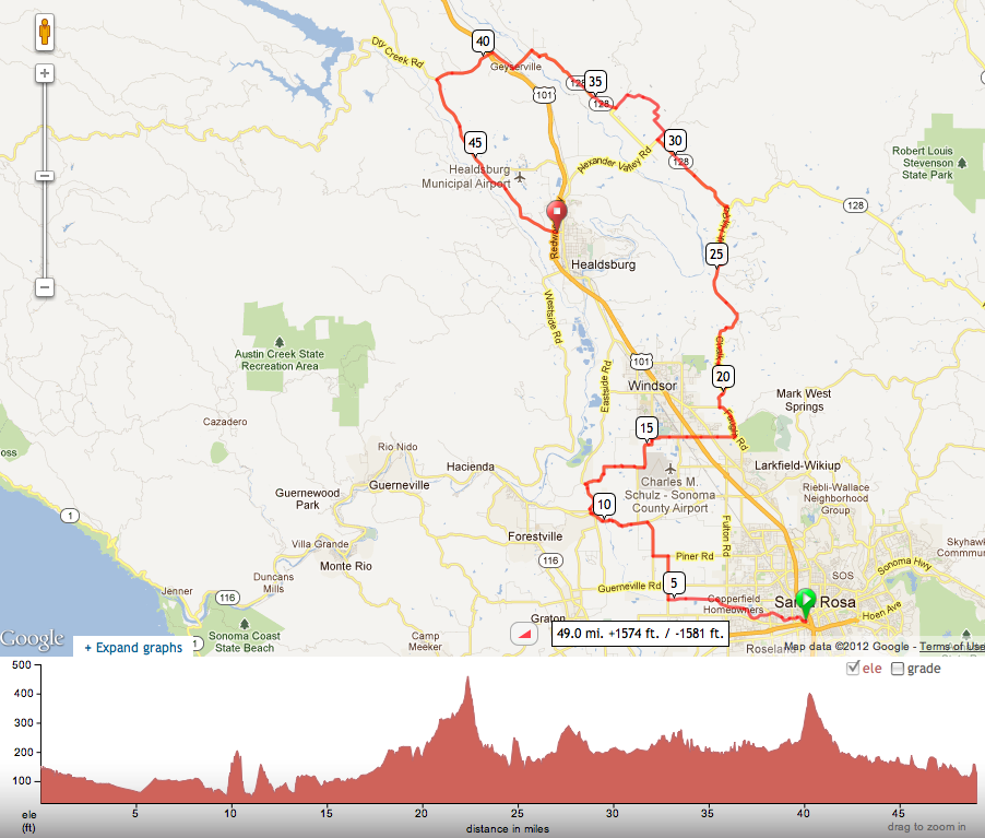 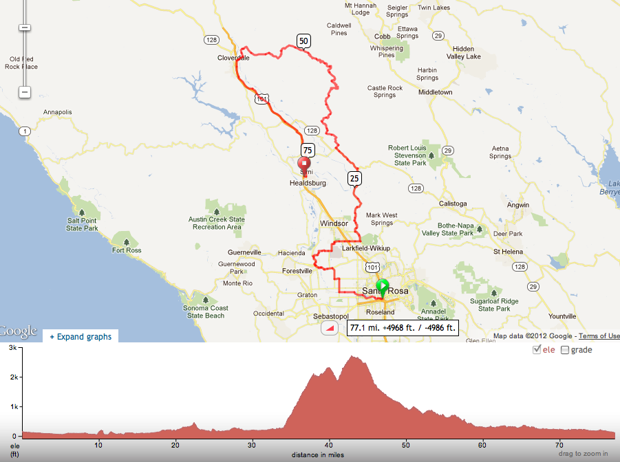 Shortest Google option is only 17.4 miles: http://g.co/maps/268qz Day 3: Tuesday, May 22nd, we follow the Russian River down to Guerneville for two nights in the redwoods. There will be three scenic options: 26.4, 35.2 & 44 miles. 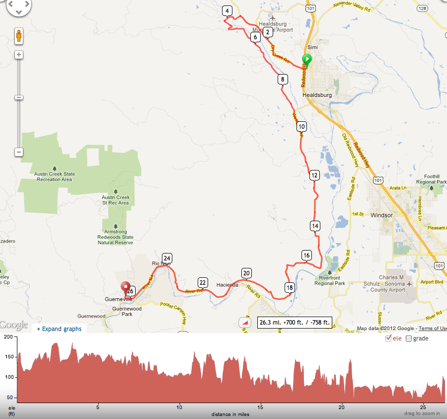 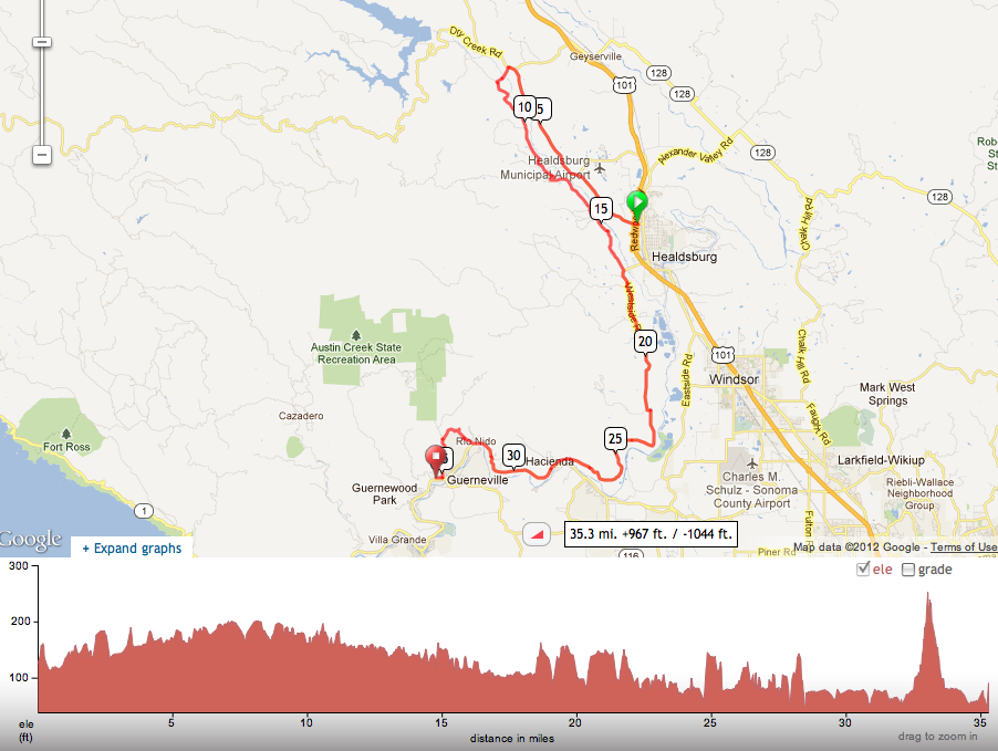 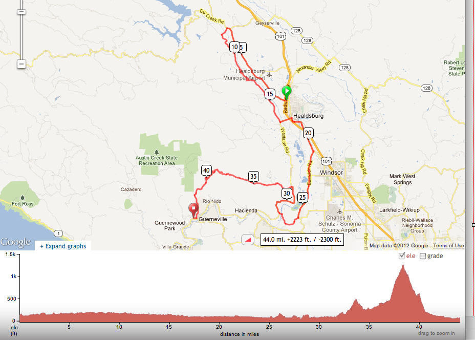 Shortest Google option is only 19.5 miles: http://g.co/maps/s4j2u Day 4: Wednesday May 23rd, three day rides will be offered: 29.2, 36.5 & 62.8 miles. 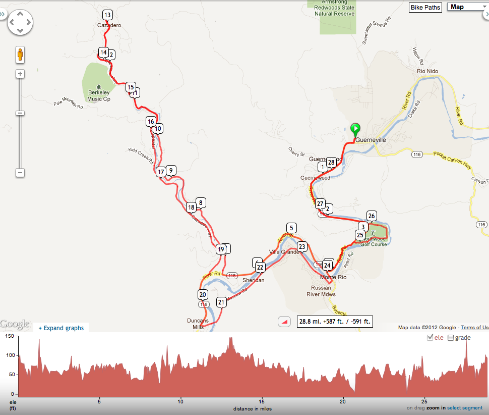 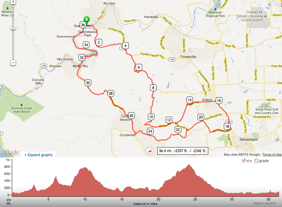 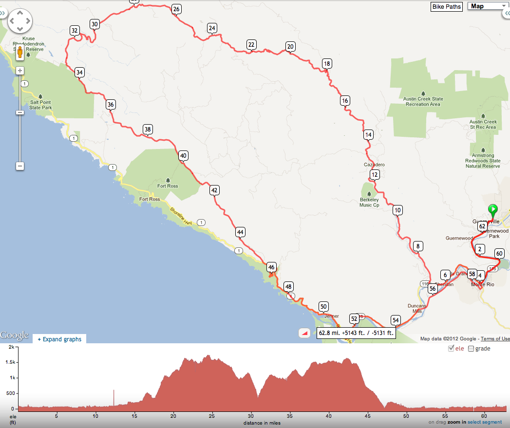 Day 5: Thursday, May 24th, we continue down the Russian River to the Pacific, then south on the California Coast to Bodega Bay. There will be several scenic options: 21.8, 25.1 & 44.3 miles. 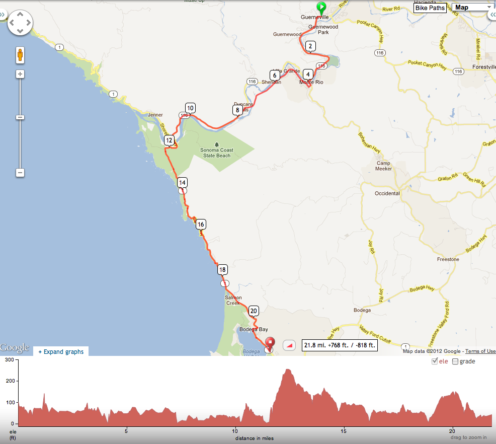 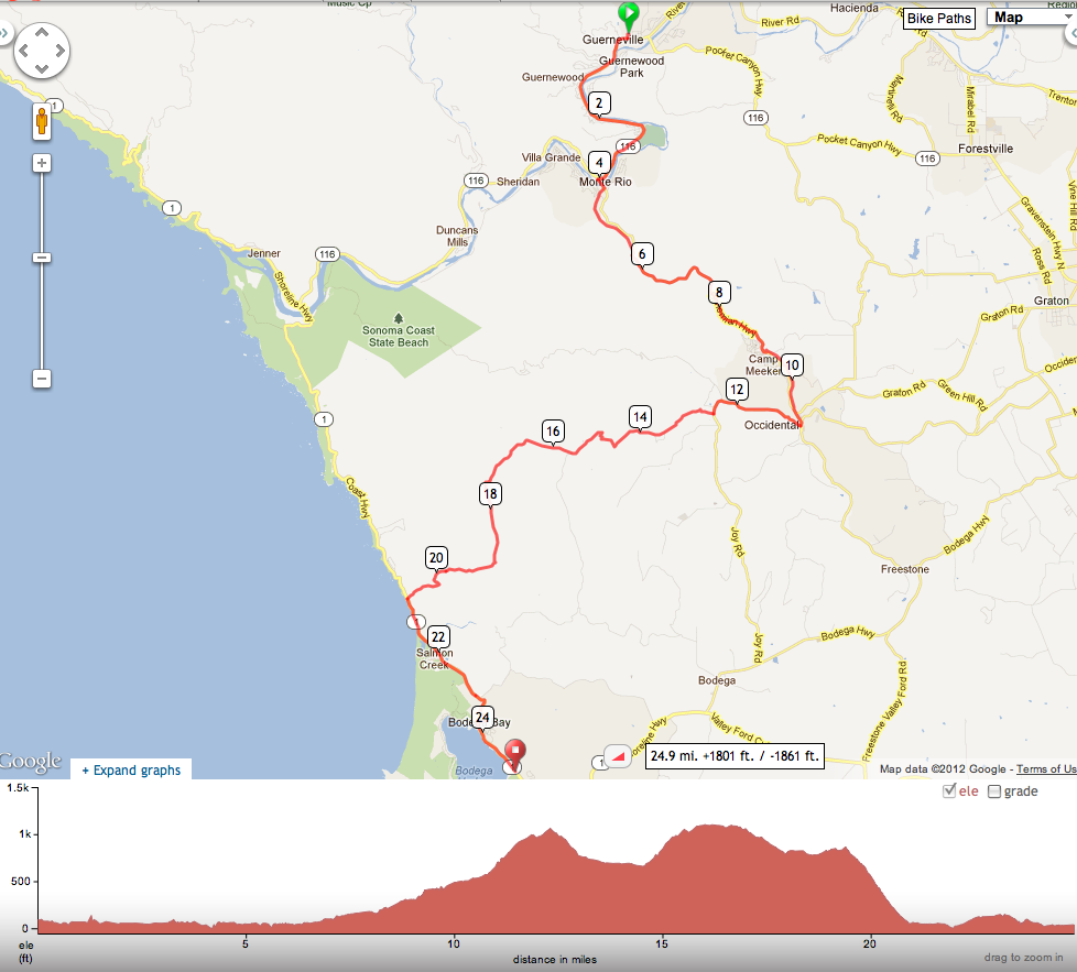 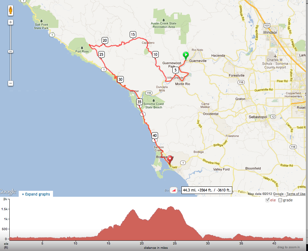 Day 6: Friday’s ride returns us to Santa Rosa May 25th. As always, there’s more than one way to get there, so you can time your riding and departure to suit your own schedule. Shuttle vans south will depart Santa Rosa in the afternoon. There will be several scenic options: 25.7, 40.5 & 62.7 miles. 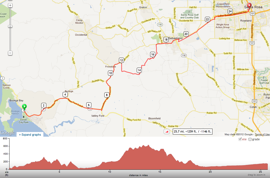 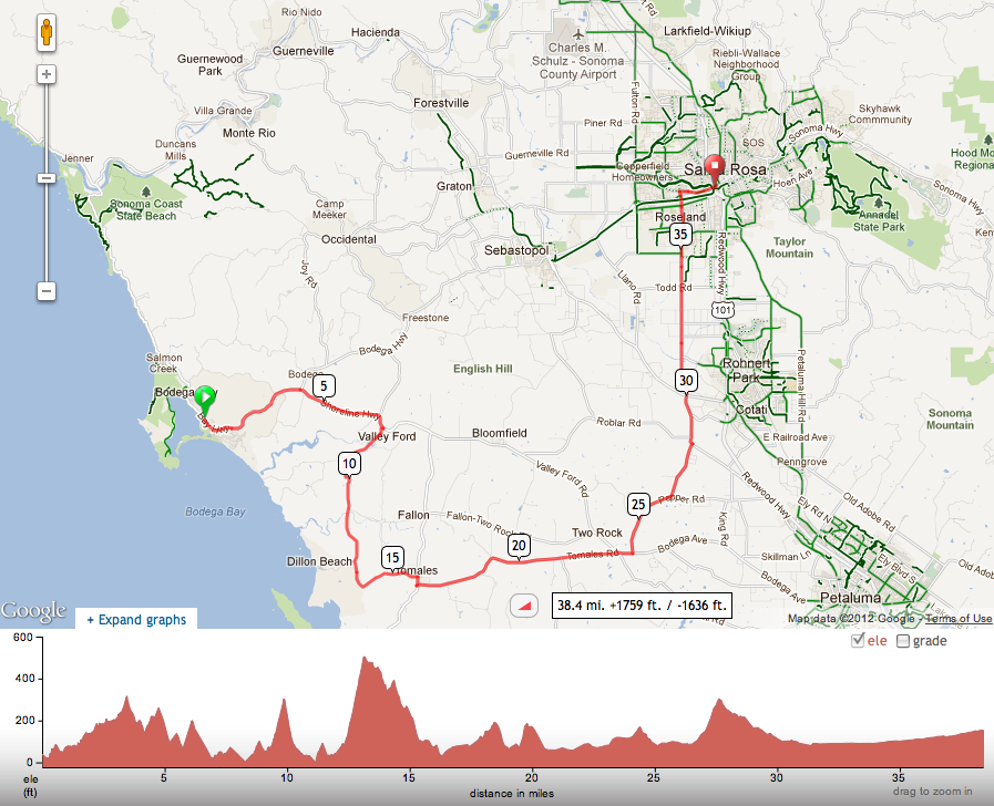 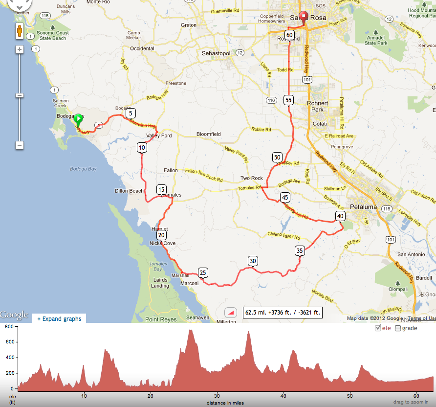 For training purposes, get into good enough
condition to enjoy a hilly 50-60 mile ride. On a tour such as this, you'll be doing 30-40 miles, kicking
back for lunch & a break, then another 20-30. That's all
you have to do all day so if you take your time it's quite accessible.
If you like on line stuff, explore Ride With GPS.com & Map My Ride.com Search for "Sonoma" "20-50 miles" & there are hundreds of routes available... The systems both give great mapping detail and generates a profile of elevation. Can also look for more Day Rides by searching "Santa Rosa" and "Calistoga".
|
